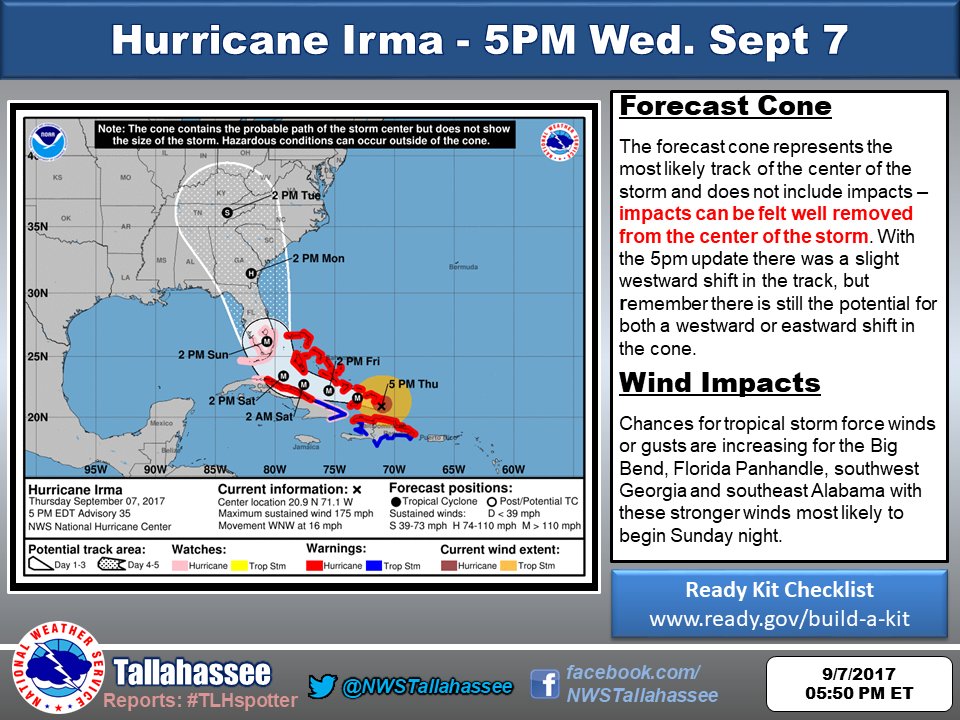
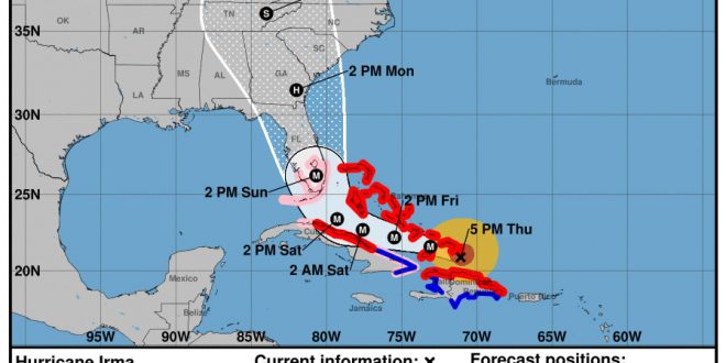
On Sept. 7, 2017 at 5 p.m. the National Weather Service released new predictions that show Hurricane Irma set to travel through the Florida Panhandle Sunday evening and into Southeast Georgia Monday morning. The predicted track of the hurricane has shifted further to the west in relation to earlier predictions.
This means that Hurricane Irma is expected to impact a larger portion of Georgia. According to the predicted track map, the eye of the hurricane will be located closer to Valdosta and Lowndes County than previously predicted. The Spectator will continue to relay all information that is provided by the National Weather Service and local authorities regarding Hurricane Irma.

Follow The Spectator on social media for current forecast tracks of Hurricane Irma. For more news stories, look here.
Story by Seth Willard. Photos by the National Weather Service.
 The Spectator The independent student newspaper of Valdosta State University


