 The Spectator The independent student newspaper of Valdosta State University


Megan Callahan, Campus Life and News Editor
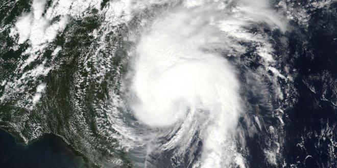
On Wednesday, Tropical Storm Isais was in the waters of eastern New Mexico. According to Associated Press, forecasters predicted, “it will strengthen into the first hurricane of the Atlantic season before striking the U.S. Gulf Coast.”
So far, the maximum sustained winds were 65 mph (100 km) and was moving east-northeast at 8 mph (13 kph), and so far, the hurricane already affected the Gulf’s oil production as well as tourism.
According to CNN, “Gov. Ron Desantis declared a state of emergency for 25 counties Tuesday, urging students to prepare disaster plans and stock hurricane supply kits. State emergency teams are staging generators, fuel, food, water, and flood barriers in the Tallahassee and Santa Rosa areas to support the response.”
Forecasters are predicting that Isaias will soon become lopsided when it arrives on the northern coast.
Hurricane Isaias advisory form from Ocean Springs, Mississippi, to the Bay/Gulf County line in Florida. All areas and counties are in danger of damage as the hurricane is passing them.
CNN states that there are several areas to be concerned, including from far southeast Louisiana to Florida.
Isaias will grow larger as it nears the coast, which means windy conditions could be felt across a wide area of the South, especially Friday night through Saturday.
Robbyn DeSpain, VSU director of strategic communications, sent an e-mail Wednesday that said the storm was tracking west of Georgia and should make landfall over the weekend.
Valdosta was in the path of two hurricanes in recent years, Hurricane Idalia in 2023 and Hurricane Helene in 2024.